Hiking in Merano, Lagundo and surrounding area
Forgetting hiking on holidays in the region of Merano is virtually impossible. Every day the stunning landscape invites visitors to explore it with hiking poles and to conquer higher regions. The region of Merano offers numerous beautiful hikes at every level of difficulty and leaves no hiking desires unfulfilled.
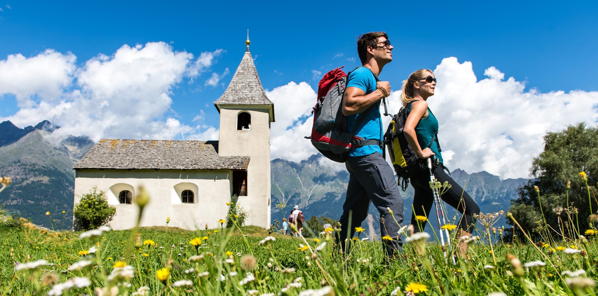
Plars di Mezzo is a part of the municipality of Lagundo bordering on Merano, beautifully situated on a hillside between orchards and vineyards. As guest in our hotel Mitterplarserhof you benefit from many varied hikes in and around Lagundo. Enjoy the Mediterranean flair during comfortable walks on the paths along the irrigation channels or extended day tours into the surrounding mountains!
An absolute must in your holidays with us are the following hikes:
Algund irrigation channel road
The Algund irrigation channel road has two parts and is 5 to 6 km long. It runs along an irrigation channel, on the plain and offers you beautiful lookout points into the Etsch Valley. The Western part begins at the car park at the Töllgraben Bridge, which can be reached with the Algund-Partschins bus or by car. The road leads you to Ober- and Mitterplars to the Grabbach and the picturesque Algund Dorf. From there, you can ascend via the Burgweg to Mitterplars or via Algund Dorf to the centre of Mühlbach. The Eastern part of the road leads you through picturesque vineyards to Gratsch and to the St. Magdalena chapel. You can either walk on if you like or return from there to Algund.
Tappeinerweg
From the town hall of Algund, walk on the Alte Landstrasse in an easterly direction. Turn left at the graveyard, cross the Grabbach and walk along the Mühlbach to Gratsch. Ascend from an exit left of the Valserstrasse to the beautiful Tappeinerweg (Mediterranean flora). You can walk along the Küchelberg to Meran using the Gilfschlucht (canyon) to the summer or winter promenade, then take the Passer promenade to the Theaterplatz. From the town centre (Rennweg), you can take the bus lines 13, or you can choose the Vellau bus to go back to Algund.
Sprons Lakes - circular hiking route
From the Leiter Alm, take path 24 in the direction of the Hochgang refuge hut. There, turn right and ascend on a steep path to the Hochgangscharte (2,441 metres) - only for people who do not get dizzy easily. At the gap, turn left and take path 6 to the Spronser Valley and the Oberkaser Alm (2,131 metres / open during the summer). Take path # 25 to your right and pass the Kaser- and Pfitscherlacke and make your way from there to the Karjoch (2,230 metres / Taufenscharte). Descend on a steep and windy path to the Leiter Alm. The round trip can also be made in the other direction.